


Voting District 3, Latimer County, Oklahoma
About
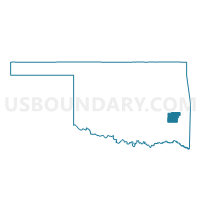
Outline

Summary
| Unique Area Identifier | 654248 |
| Name | Voting District 3 |
| County | Latimer County |
| State | Oklahoma |
| Area (square miles) | 126.06 |
| Land Area (square miles) | 125.33 |
| Water Area (square miles) | 0.73 |
| % of Land Area | 99.42 |
| % of Water Area | 0.58 |
| Latitude of the Internal Point | 34.97428490 |
| Longtitude of the Internal Point | -95.36459170 |
Maps


Graphs
Select a template below for downloading or customizing gragh for Voting District 3, Latimer County, Oklahoma


Neighbors
Neighoring Voting District (by Name) Neighboring Voting District on the Map
- Voting District 1, Latimer County, OK
- Voting District 10, Latimer County, OK
- Voting District 18, Pittsburg County, OK
- Voting District 2, Latimer County, OK
- Voting District 26, Pittsburg County, OK
- Voting District 33, Haskell County, OK
- Voting District 34, Pittsburg County, OK
- Voting District 4, Latimer County, OK
- Voting District 44, Pittsburg County, OK
- Voting District 5, Latimer County, OK
Top 10 Neighboring County Subdivision (by Population) Neighboring County Subdivision on the Map
- Wilburton CCD, Latimer County, OK (5,960)
- Quinton CCD, Pittsburg County, OK (5,214)
- Hartshorne-Haileyville CCD, Pittsburg County, OK (5,084)
- West Haskell CCD, Haskell County, OK (3,646)
- Red Oak CCD, Latimer County, OK (2,320)
Top 10 Neighboring Unified School District (by Population) Neighboring Unified School District on the Map
- Wilburton Public Schools, OK (5,339)
- Hartshorne Public Schools, OK (4,012)
- Crowder Public Schools, OK (2,827)
- Quinton Public Schools, OK (2,244)
- Panola Public Schools, OK (1,479)
- Kinta Public Schools, OK (1,351)
Top 10 Neighboring State Legislative District Lower Chamber (by Population) Neighboring State Legislative District Lower Chamber on the Map
Top 10 Neighboring State Legislative District Upper Chamber (by Population) Neighboring State Legislative District Upper Chamber on the Map
Top 10 Neighboring 111th Congressional District (by Population) Neighboring 111th Congressional District on the Map
Top 10 Neighboring Census Tract (by Population) Neighboring Census Tract on the Map
- Census Tract 872, Latimer County, OK (5,960)
- Census Tract 4867, Pittsburg County, OK (5,084)
- Census Tract 2793, Haskell County, OK (3,646)
- Census Tract 4857, Pittsburg County, OK (2,442)
- Census Tract 871, Latimer County, OK (2,320)
Top 10 Neighboring 5-Digit ZIP Code Tabulation Area (by Population) Neighboring 5-Digit ZIP Code Tabulation Area on the Map
- 74501, OK (29,073)
- 74578, OK (6,822)
- 74547, OK (3,463)
- 74561, OK (2,175)
- 74563, OK (2,042)
- 74552, OK (1,058)